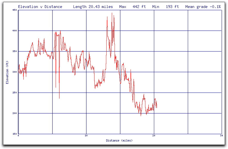
The good folks at RIDE-Arc have been so kind as to scare the crap out of less-seasoned enthusiasts send to the recipients of their maillist graphic proof that tomorrow night’s ride will have ups and downs. That, or it’s a seismograph readout; or maybe a 20-year commodities chart plotting the price fluctuation of porkbellies (click to doublify):
The graph illustrates another important point. The beginning of the 20-mile ride is around 300 feet above sea level, whereas the end is somewhere around 225, which could be interpreted as not finishing where it starts, and that means a bit more mileage getting home.
Certainly I’m not averse to more mileage (as yesterday’s 43.5-mile work commute + river ride can attest), but when you factor in all that climbing and then the potential extra distance required to get home (probably at something like two o’clock in the morning… I’m pretty sure that means I’ll be leaving The Phoenix home that night and bringing my Giant OCR-3 roadie and its 24 gears out of suspended animation and along for the ride.

 Follow